WEEKEND WEATHER / WALI UPDATE
Trade wind weather is expected through Saturday morning with our typical morning and evening windward and mauka showers. Isolated showers for leeward areas with some windward moisture pushing into lee spots from time to time on our 15 – 20+ mph easterly winds. Highs upper 80′s to maybe even 90 degrees. Lows in the 70′s.
Once the effects of WALI take hold we have the potential for heavy rain and even thunderstorms. It’s for that reason that the National Weather Service has issued a FLASH FLOOD WATCH from Saturday morning to Monday evening for Maui and the island of Hawaii. (All other islands are under the watch from Saturday evening through Monday evening) A FLASH FLOOD WATCH means that conditions may develop that could lead to flash flooding. It’s a heads up. If the WATCH gets upgraded to an ADVISORY (imminent threat) or WARNING (happening) we will post it right away. Along with the potential for rain will come humid and muggy conditions. For Maui County we expect to start feeling the effects of WALI on Saturday morning. The greatest chance of flooding will occur over windward slopes with lesser chances for leeward spots. At this point the National Weather Service is estimating up to 6 – 10 inches of rain for the wettest areas.
Here is a Hawaii State Civil Defense PSA on Flooding & how to stay safe
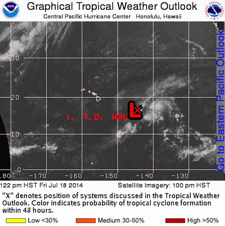
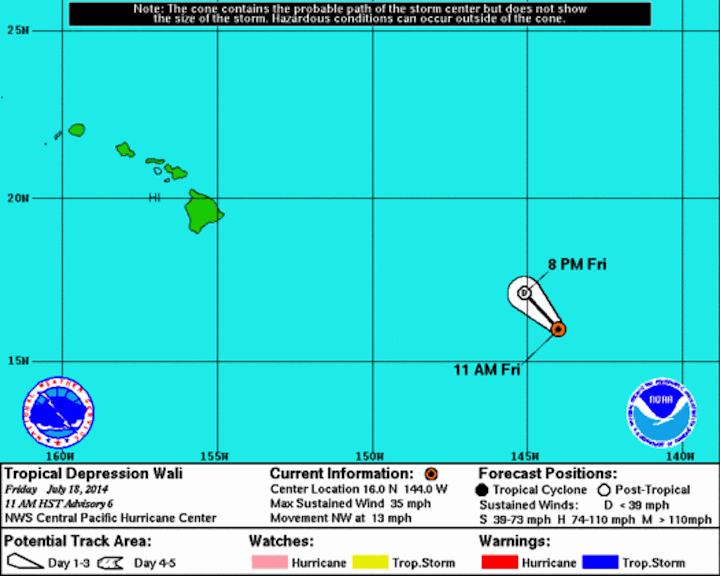
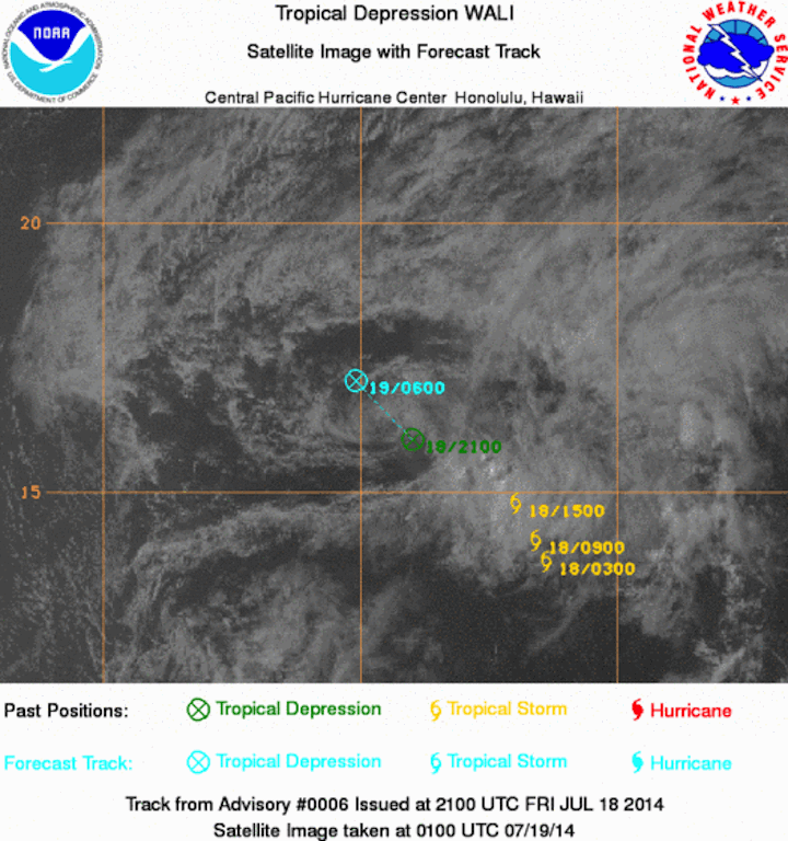
WALI STATS: The remnants of Wali are currently about 820 miles ESE of Kahului, Maui. Moving NW at about 12 mph. The National Hurricane Center says the window has closed for WALI to intensify and the depression has fizzled into a remnant low.
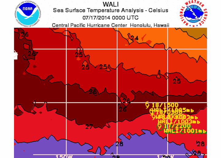
Last set of WALI images from CPHC
Here are some Tropical Preparedness Tips from the CPHC
During a hurricane or tropical storm event, if you live inland away from the beach, and away from low-lying areas, and your home is well constructed, stay at home.
Once a hurricane or tropical storm arrives in your area, remain indoors in an interior room. Blowing debris can be deadly. Travel should be avoided. Plan now and have a disaster supply kit on hand.
When a hurricane threatens, monitor your radio or television for the latest National Weather Service advisories, as well as any special instructions from Civil Defense.
Hurricanes can cause power failures and cut off, or contaminate water supplies. Store a 7 day supply of water you can use for drinking, cooking, and bathing. Check battery powered equipment such as radios and flashlights.
Keep 7 days worth of non-perishable foods on hand and 2 weeks worth of special medication. Remember, stores and pharmacies may not be open during an emergency, when you need supplies.
MECO PRESS RELEASE on how to prepare for a storm
§ Turn off and unplug unnecessary electrical equipment, especially sensitive electronics which could be damaged by a power surge.
§ Turn your refrigerator and freezer to their highest settings. If power goes out, keep the fridge and freezer closed as much as possible and food will stay fresh longer. (Make sure to turn the settings back to normal levels after the storm has passed.)
If your power goes out:
§ If you plan to use a portable generator, make sure it is in a well-ventilated area, preferably outside. Don’t plug the generator directly to your household electrical outlets; this can cause power to flow back into power lines causing a safety hazard. Instead, plug appliances directly into the generator using heavy-duty extension cords.
§ Use flashlights instead of candles or kerosene lamps which can pose a fire risk. Be especially careful with cooking flames indoors as a gust of wind could start a fire.
§ Don’t use charcoal or other fossil fuels to cook indoors as they can create deadly carbon monoxide fumes. Cook only in well-ventilated areas.
§ Leave one light on so you’ll know when your power returns.
If you see a downed power line:
§ Do not touch fallen or low-hanging wires or anything the wires may be touching; assume every wire is still energized and dangerous. Stay clear of puddles where downed lines may have landed. Stay away and warn others to stay clear. Call the Maui Electric Trouble Line at 871-7777 on Maui or 1-877-871-8461 on Moloka‘i and Lana‘i. Call 911 for immediate emergency help.
§ If a power line has fallen on a car that you are in, stay inside the car if possible and wait for help. If you can, try to break contact with the line by driving the car away from it. If you need to get out of the car right away because of some other pending danger like fire, jump out and away from the car so that your body clears the vehicle before touching the ground and try to land with two feet. Do this to avoid having your body become an electrical path from the car to the ground.
HAWAII STATE CIVIL DEFENSE HURRICANE SAFETY PSA


Friday, August 15th 2014 at 10:18 pm
[…] So far here on Maui the kids have been to Hana, they did a west side tour, a south side tour, a Haleakala tour, Iao Valley, they went to a luau, had surf and canoe lessons and will go on a boating trip out to Molokini (if weather permits! Yikes! How’s this storm coming? PS – I have a blog on the latest – click HERE). […]
Friday, July 18th 2014 at 11:15 am
[…] So far here on Maui the kids have been to Hana, they did a west side tour, a south side tour, a Haleakala tour, Iao Valley, they went to a luau, had surf and canoe lessons and will go on a boating trip out to Molokini (if weather permits! Yikes! How’s this storm coming? PS – I have a blog on the latest – click HERE). […]