
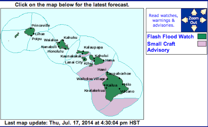
UPDATE: The National Weather Service has issued a FLOOD WATCH for all HAWAIIAN ISLANDS in effect from 6:00pm SATURDAY to 6:00pm MONDAY. (With the possibility of being extended if heavy rain persists)
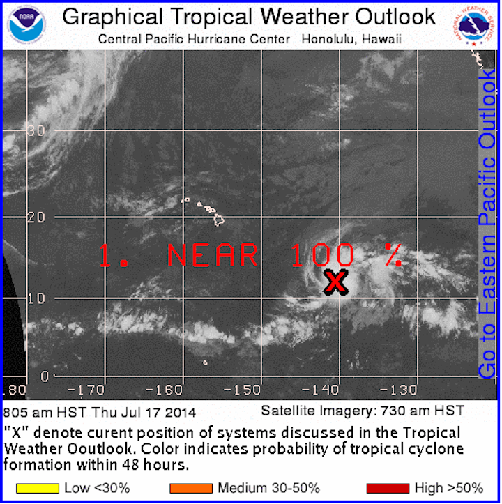
ORIGINAL POST: According to the National Hurricane Center, ONE-C strengthened into a Tropical Storm WALI far southeast of the islands around noon today. According to Kupuna Kalo, “wali” means smooth, thin, supple, limber, as a dancer’s body.
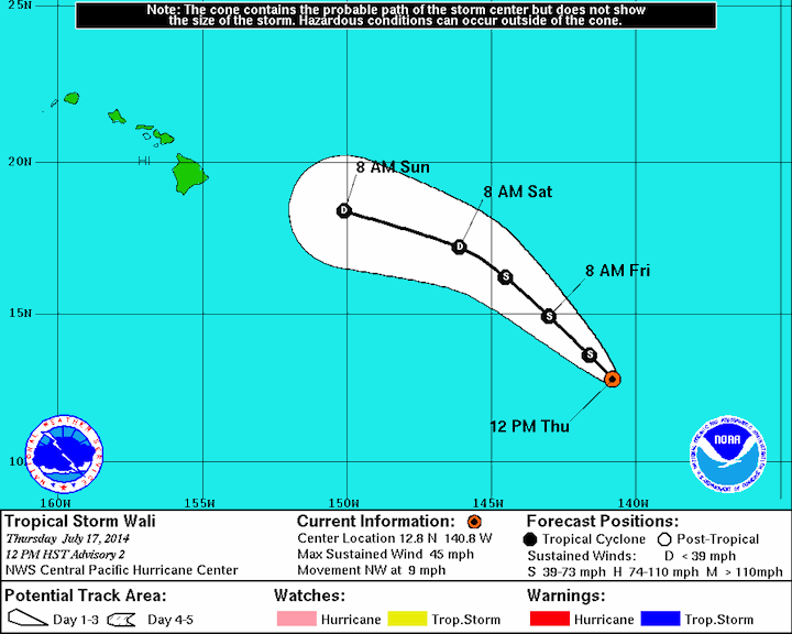
The storm is moving northwest at about 9 mph. This motion is expected to continue until the weekend. Right now winds are at 45 mph with higher gusts. Tropical storm force winds extend 90 miles from the center and the storm is still more than 1000 miles away from the Hawaiian Islands.
The storm increased in strength overnight and into today. Additional strengthening is expected over the next 12 – 24 hours before the storm is expected to drastically weaken. Right now, there are no hazards affecting land and there are NO watches or warnings in effect for the Hawaiian Islands.
So how will Wali AFFECT US? Moisture including the possibility of heavy showers are expected Saturday night through Monday night. Conditions will also be very sticky and muggy during that time. The Big Island and Maui should see the effects starting Saturday night with the rest of the islands being affected on Sunday.
Continue to track WALI on your own by clicking on the image below:
Stay safe during Hurricane Season!
Here are some quick tips and information you need to know to be prepared:

Saturday, December 12th 2015 at 9:58 am
[…] first named storm of the season for the Central Pacific (Tropical Storm Wali) is expected to come blowing past the Hawaiian Islands […]